A look at the history of the Creekside.
In this series of features on the Creek let’s now start a stroll along its banks to see how its town reach has evolved over the ages. To plan properly for the future you have to understand the past, and nowhere is this more true.
The best place to begin is at Stonebridge Pond, one of Faversham’s great beauty spots, at the end of West Street. Remember that before it became part of the Home Gunpowder Works in the 17th century its waters would have been tidal and that small sea-going vessels may once have been able to reach the lower end of Tanners Street, where the town’s first Guildhall stood.
Turn back towards the town, across the Westbrook, which feeds the Pond, and then turn left down Flood Lane. This was once lined by houses on either side, and here at work a hundred years ago you could have seen a stave-maker. He soaked his wood in the waters of the Pond and then bent them into shape for the barrels coopers made for the brewing and gunpowder industries.
The Lane isn’t so called because it floods, but because it led to the town’s Flood Mill, owned in the 16th century by Thomas Arden, of Arden of Feversham fame. This in turn was so called because it was a tide mill. At flood tide salt water built up in the Pond behind it, then at low tide was released slowly to power its water-wheel.
In 1559, as you’ll remember from an earlier feature in this series, it was displaced by a sluice designed to flush the Creek clear of silt. There is still a sluice behind the brick wall which conceals the Pond at this point but its purpose now is only to control water levels. Alongside it there are remains of gunpowder mills.
On the left of the Lane, where houses once stood, is a pleasant expanse of greensward, with an attractive view over the Pond. It’s bounded by one of the narrow-gauge canals that were used by punts to move gunpowder from process to process. This was safer than moving it by carts whose iron-shod wheels might strike dangerous sparks off the flints in a track.
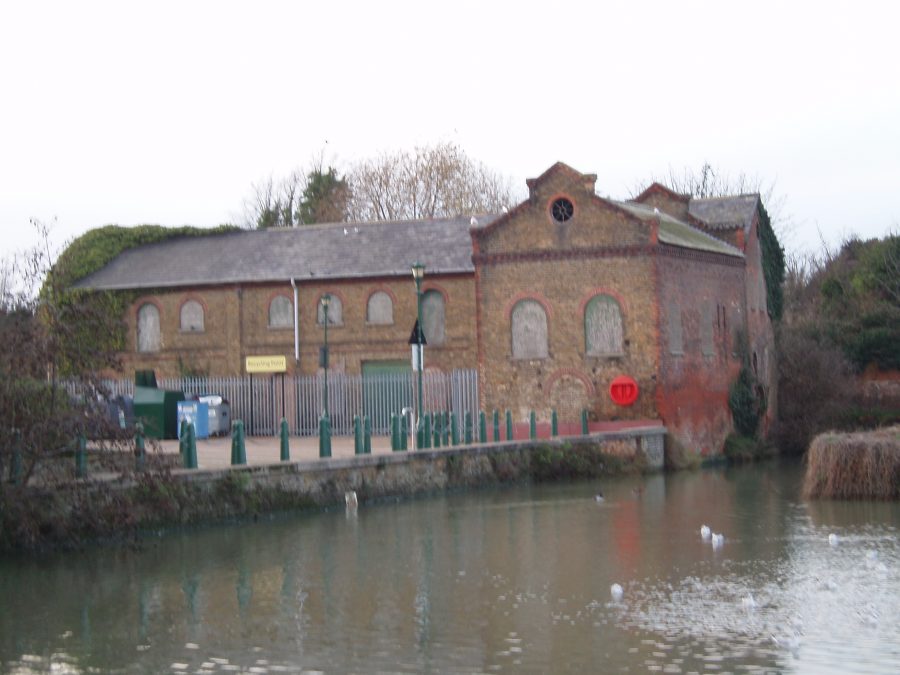
The Lane narrows towards its end. On the right is the Purifier Building, the only surviving relic of the town’s Gas Works, opened in 1830. It goes back to the 1870s or 1880s, and derelict for years, but now recently occupied by the Faversham Creek Trust, to be used as a Boatbuilding School – at last the first step towards rejuvenating the Basin.
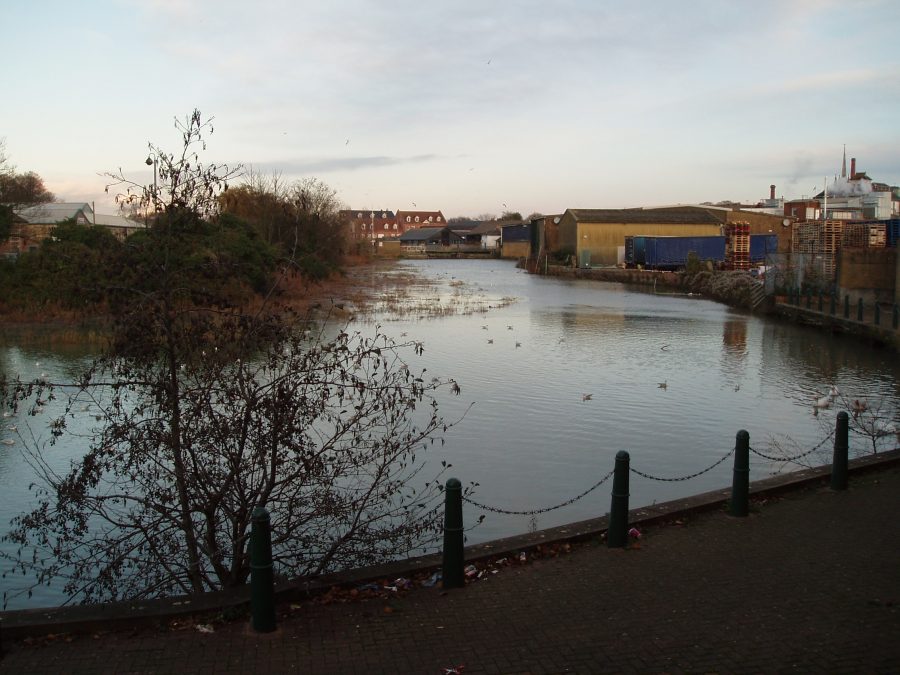
You could pop through into Morrison’s car park at this point to get your first glimpse of the Creek basin. There’s a short Creekside walk which it’s hoped one day – eventually! – may be extended as far as the Bridge.
Next on your right comes Ordnance Wharf, whose future is also uncertain. As its name implies, it was built by the Board of Ordnance when the Government nationalised the Home Works in 1759. Here deliveries of sulphur and saltpetre arrived, and cargoes of gunpowder left.
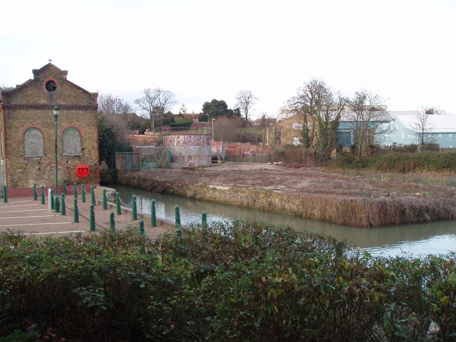
Towards the end of the 18th century the Borough Council became unhappy at such hazardous cargoes awaiting a tide so close to the town centre, so persuaded the Board to route them out via Oare Creek instead. A hundred years later a ship chandler had his premises here.
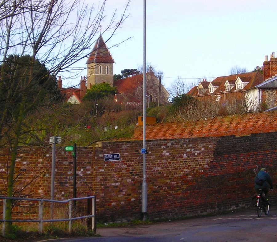
The far end of Flood Lane brings you into Brent Road, at the foot of Brent Hill. You’re now at the head of the Creek, and what a contrast! No more greensward, but a factory on one side of the road, and its car park on the other. Cast a glance back up Brent Hill (pictured). You realise, if you haven’t realised before, that Davington Priory is as close to the Creek as the Parish Church – so the building stone it needed when it was founded in 1153 could be delivered by water.
