We focussed in Part 1 on the geological origins of Faversham and Oare Creeks and the pattern of well-watered valleys which once fed them. Now a look at their early history, about which in truth not a lot is really known.
Geographers tend to describe creeks and inlets like these as ‘rias’, from a Galician word meaning valleys drowned by the sea. “The branching creeks near Faversham have been produced by marine drowning of an essentially ‘dry valley’ topography,” says the offcial account of The Geology of the Country around Faversham.
There are many parallels in southern England, among them Chichester Harbour, Poole Harbour, the creeks around Shalfleet in the Isle of Wight, and the estuaries of the rivers Exe, Dart, and Fal (think of maps or aerial photographs of places like Topsham, Dartmouth and Falmouth).
In other words the Creeks only became navigable after tidal salt water swept up them from the Thames Estuary. Otherwise they would have remained shallow mini-rivers. So far, so good. However when historic times are reached there is a complication, the implications of which still need to be worked out, and understood.
Archaeological and other research strongly suggests that when the Roman Emperor Claudius invaded, and annexed, Kent in AD 43 local sea levels were much lower than they are today – by as much as 15 feet. This would mean that neither Creek would have been navigable, except at very high tides by shallow-draught vessels.
And yet several local Roman villa (farmstead) sites are close either to the Creeks or nearby inlets; and it seems likely that they were located where they were to be near navigable waters, so that products could be ‘exported’ to London and elsewhere. It tends to be assumed, for example, that the villa excavated near Abbey Farm in 1964 was located where it was because it was close to Faversham Creek.
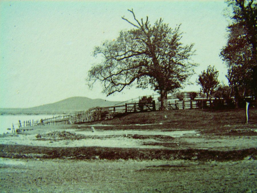
It has also been suggested that the artificial mound known as Nagden Bump (seen here in the background before it was levelled in 1953) was raised as a foundation for a Roman lighthouse. Here are puzzles to which knowledgeable readers may know the answers.
What is for sure is that in 699 somewhere in or close to Faversham was a place called Cilling (probably pronounced Chilling) and that, if not a home of royalty, it had close royal associations, since Wihtred, King of Kent, issued an important charter there in that year. More importantly – for Faversham Creek – it was later, in 814, described as a port.
On the basis of available documentary evidence, no scholar has yet managed to pinpoint it, but suggestions have been made that it lay by Ewell Fleet, about 600 yards north of Ewell, on the Graveney Road, or was simply a locality in Faversham itself – where at Kings Field there was a major burial ground whose name suggests that had royal associations.
By 811, when it’s first mentioned as ‘Fefres ham’, the town must have been well-established, because it’s described as such (‘oppidum’ in Latin). What’s more, it’s described in Latin as ‘regis’ (owned by the King), so the case for its identity with, or at least close affinity to, Cilling perhaps becomes stronger.
In its position alongside its Creek it must have been a port, and there are indications that, though a ‘limb’ (associate) of Dover, it was an original member of the Confederation of Cinque Ports when this was formed in the 10th century. By 1086 it also boasted a market – the oldest in the present county of Kent.
It’s clear in fact that Faversham would never have emerged as a town without its port. The Creek was its major asset, over-riding the disadvantage that the town’s site lay north of the Roman Watling Street (A2). The more so, too, because after Roman times the roads were in poor shape, as they remained for hundreds of years, and most freight and passenger transport was by water.
