24 years isn’t a long time – or is it? In 1987 in its ‘Nutshell Guide’ series the Faversham Society published a booklet on Faversham Creek. This took the form of, first, a brief history (11 pages), and then a trail from the Creek head at Flood Lane and the foot of Brent Hill to Nagden (14 pages).
Already, in 2011, the trail is now hopelessly out-of-date. Most of the features it highlights between the Creek head and Standard Quay have either vanished or seen dramatic changes of use. They’re consigned to history. Most of them anyone who is new to the area will never have seen, be amazed that they ever existed. “You mean to say there used to be an animal feed mill, and before that a cement works, where I live?” and so on.
How come? Well, before that question’s answered, something about how the Creek comes to be here, and what part it has played in the area’s long history.
Take a look at the local 1”-scale sheets of the British Geological Survey, in particular those for the Faversham, Canterbury and Maidstone areas. They’re on sale at the Fleur de Lis Heritage Centre. Colourful affairs, they show very clearly (particularly the Canterbury one) slender green ‘fingers’ stretching rather like tree roots up the dip slope of the North Downs. ‘Dendritic’ is the term the experts use for this very distinctive pattern.
These green fingers mark where the underlying chalk comes close to the surface , and signify valleys. Every reader will probably be familiar with these – they are well-loved features of the local landscape, and outstandingly beautiful.
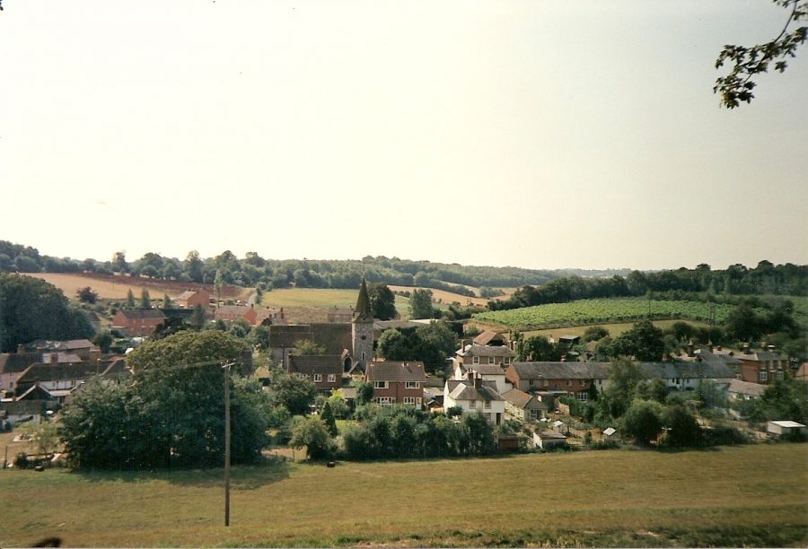
The Faversham Creek valley runs through Water Lane and Lorenden Park in Ospringe, and its tributaries to the top of the North Downs at Otterden, Stalisfield, and Throwley. Just to the west is the Oare Creek valley, better known as Syndale (‘wide valley’) or the Newnham Valley, as far as Doddington, and then also reaching the top of the North Downs at Frinsted and Otterden. Seen here is the village of Newnham, in the main valley, with a tributary valley coming down from Otterden.
The further south you go, the narrower the valleys mostly get, so the lanes which cross them are often very steep. From the tops of some of them they are striking distant views northwards. The countryside, thankfully, is all unspoiled.
How come, in turn, these valleys exist? They’re now dry, but surely they must have been formed by running water? Yes, indeed. In the Ice Age permafrost never extended south of the Thames Estuary, but it was still very cold, and snow capped the top of the North Downs for most of the time. When it melted it had to find its way to the sea, and in doing so it created these valleys.
But the underlying chalk is permeable and the water could simply have drained down into it? Yes, but the ground often remained frozen, and then the water could only drain off over it. The streams brought down with them flint and gravel deposits, and long after they had dried up, from the 20th century till today, these have been exploited for use in road metalling and construction work.
These streams dried up many millennia ago, but towards the north end of their courses springs provided residual water sources for the two Creeks, which were also swept by tidal waters. Though in each case springs may once have risen higher up their courses, Oare Creek came to be fed by springs along Bysing Wood Road and Faversham Creek by ones rising just beyond Lorenden Park. Because of ever-increasing demand on the aquifer, the latter (‘the source of the Nile’ jokingly)finally dried up about 40 years ago, and the only permanent springs left to feed Faversham Creek with fresh water rise in the stream bed outside Chart Gunpowder Mills and at the SW corner of Stonebridge Pond.
